Bayeux War Cemetery
- Country France
- Total identified casualties 4258 Find these casualties
- Region Calvados
- Identified casualties from Second World War
- GPS Coordinates Latitude: 49.27412, Longitude: -0.71399
Please note:
To protect the lawn, please use the new temporary entrances on either side of the main entrance.
PLEASE NOTE
Important restoration works are currently being carried out on the Bayeux Memorial to the Missing. These works are essential in safeguarding the future of the memorial and will protect it for decades to come.
These works form part of a long term, carefully planned programme designed to ensure that we can continue to honour the nearly 1,800 service personnel commemorated here with dignity.
We have ensured the names of those on the Memorial remain available through the Registers on site, as we know how much this visit can mean for returning veterans and families.
The work is expected to be completed by August 2026.

Go on a virtual visit to Bayeux War Cemetery
Bayeux War Cemetery and Memorial have For Evermore tours available using the FREE app for mobile phones and tablets. The tours cover different aspects of the site and the Commonwealth servicemen and women we commemorate within the grounds.
The app can be used remotely or, If you are visiting the cemetery, you can use the tour to follow a path around it, reading the stories along the route. There is also a scan function allowing the user to scan a headstone and bring up the related casualty information throughout the cemetery.
The For Evermore app can be downloaded from the links below.
Access the Bayeux virtual tour via the For Evermore app, available on IOS and Android.
Download FREE app for iOS Download FREE app for Android
SHARE THE STORIES OF D-DAY AND NORMANDY
If you'd like to know more about who we commemorate, visit For Evermore: Stories of the Fallen, the CWGC online commemorative resource. Here you can read and share the fascinating stories from some of the people who took part in D-Day and Normandy Campaign.
Location information
The town of Bayeux, in Normandy, lies 30 kilometres north-west of Caen. Bayeux War Cemetery is situated in the south-western outskirts of the town on the by-pass (D5), which is named Boulevard Fabian Ware. On the opposite side of the road stands the Bayeux Memorial.
Visiting information
ARRIVAL
The route to the cemetery is signposted.
PARKING
The main entrance to the cemetery is off the main road, boul. Fabian Ware, opposite the Bayeux Memorial.
Approximately 300 metres from the cemetery is Musee de la Bataille de Normandie, where there is a large car park with space for multiple vehicles.
The route from the car park to the memorial is along a pedestrian path at the side of the main road.
The ground is flat and firm with a tarmac surface.
It is not possible to park in front of the cemetery.
ACCESS LAYOUT AND MAIN ENTRANCE
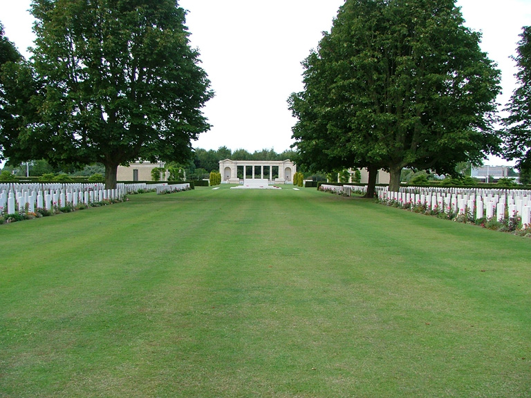
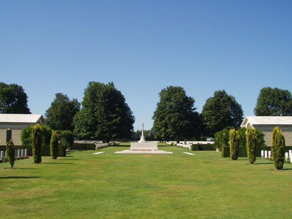
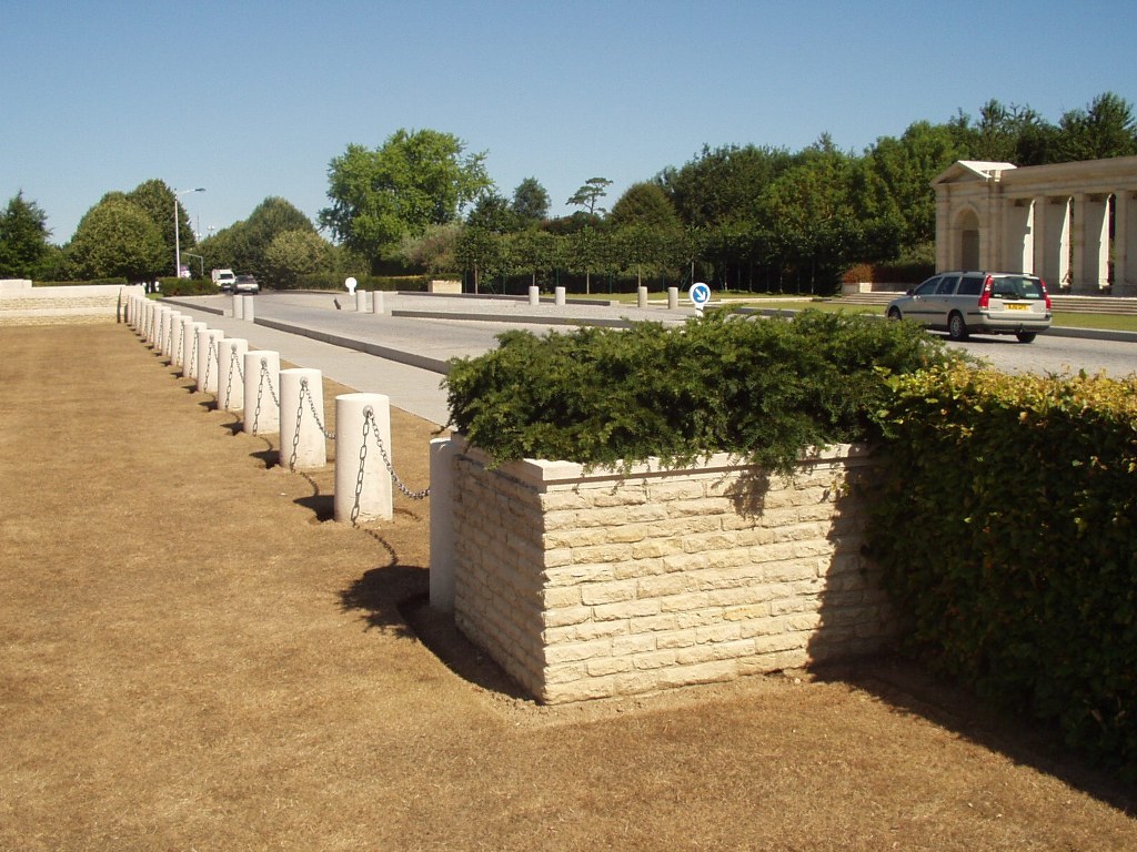
The main entrance gate is eight metres wide and stretches across a wide brick paved entrance area. Three sets of double latched gates, each pair 2 metres wide open outwards. There are seating areas located on each side of the main entrance opening.
The entrance is approximately 3 metres from the pedestrian pathway on the south side of the road. The ground is comprised of level stone paving and is step-free into the cemetery.
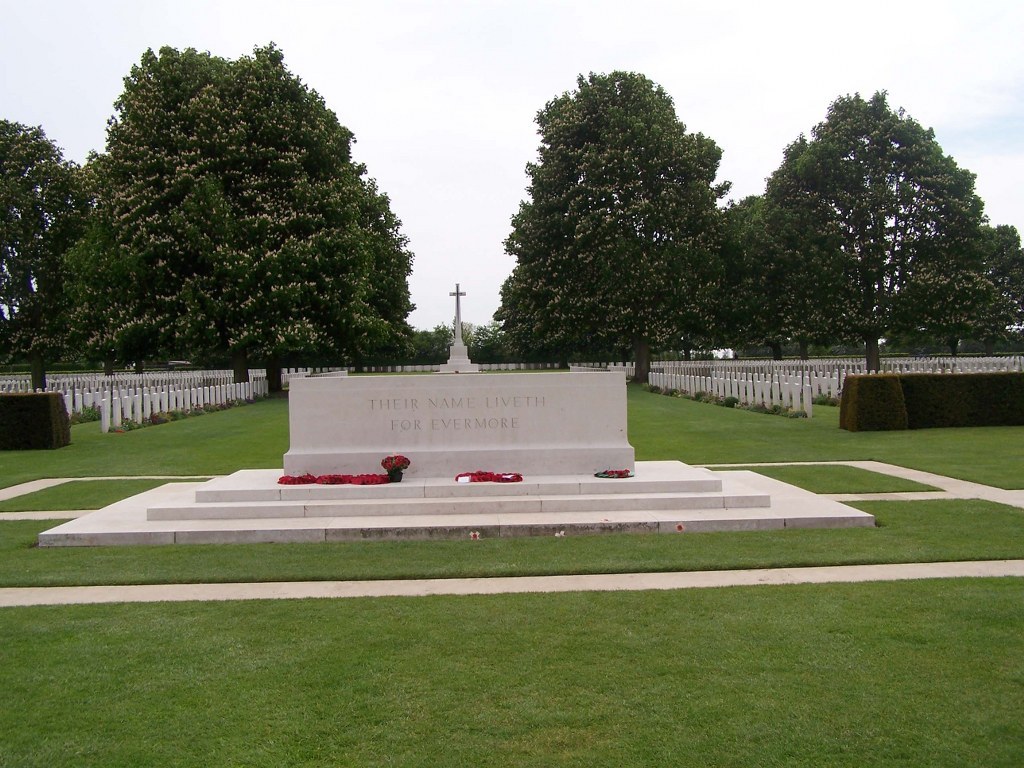
The Stone of Remembrance is approximately 50 metres from the entrance. Shelter buildings are located on either side of the Stone of Remembrance.
The shelter buildings have stone benches located inside, and the Register Box is located in the shelter building to the right of the Stone of Remembrance, looking inwards to the cemetery.
There are external semi-circular seating areas located to the rear of each shelter building, as well as timber benches opposite these areas.
There are multiple timber benches located around the perimeter of the cemetery, many under trees.
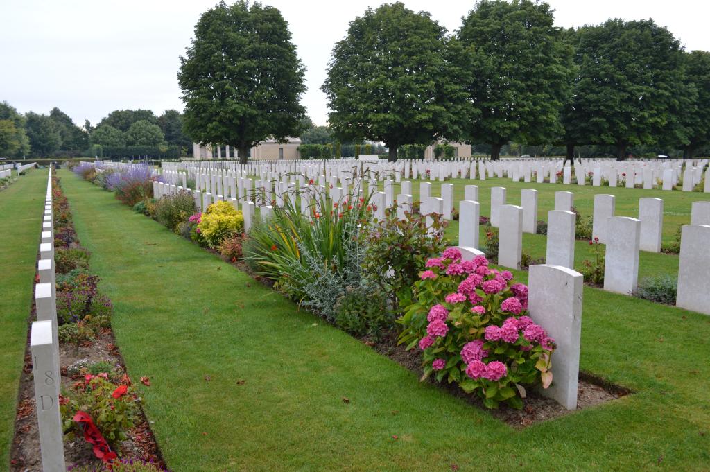
All internal cemetery paths are grass, the ground is flat and firm.
ALTERNATIVE ACCESS
It is possible to access the cemetery from the rear of the site, via the staff parking area, but not possible to park in staff parking.
ADDITIONAL INFORMATION
The cemetery is permanently open.
Access to the cemetery is within three metres of the pavement and 25 metres from the entrance to Bayeux Memorial, across a pedestrian crosswalk. The main road is comprised of two single lanes for vehicle traffic, and a 4 metre-wide paved island between. The road is cobbled with flat paving stones for pathways adjacent to the roadway.
History information
The Allied offensive in north-western Europe began with the Normandy landings of 6 June 1944.
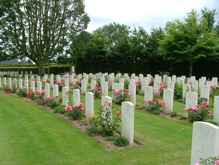
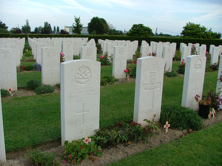
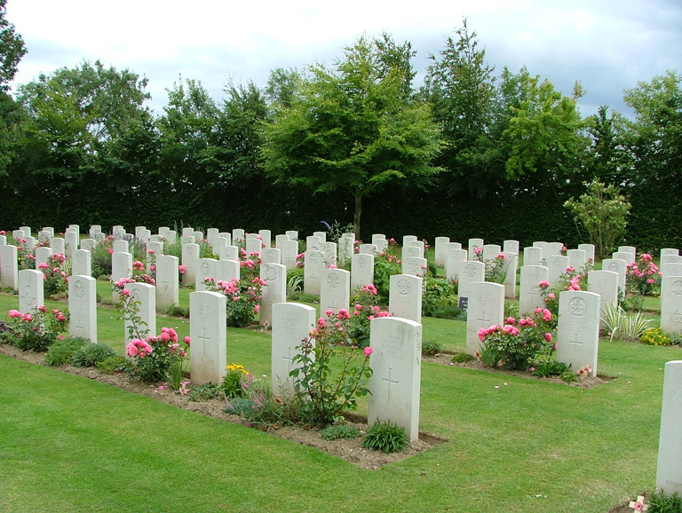
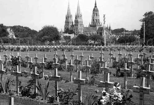
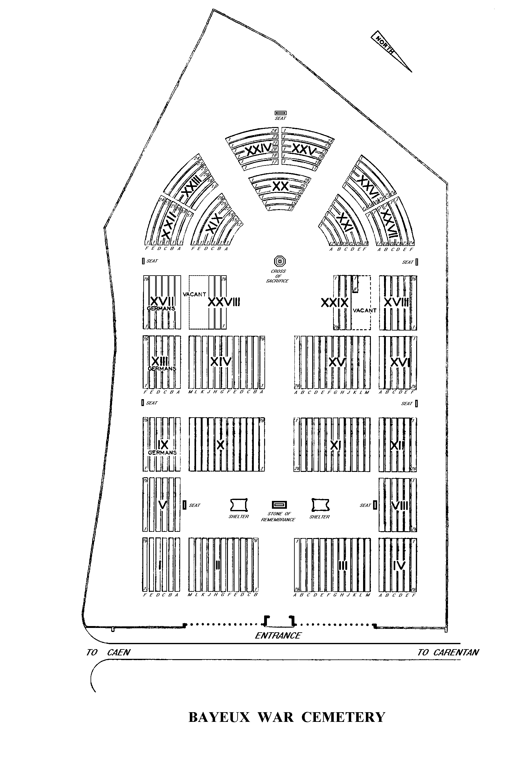
There was little actual fighting in Bayeux although it was the first French town of importance to be liberated. Bayeux War Cemetery is the largest Commonwealth cemetery of the Second World War in France and contains burials brought in from the surrounding districts and from hospitals that were located nearby.
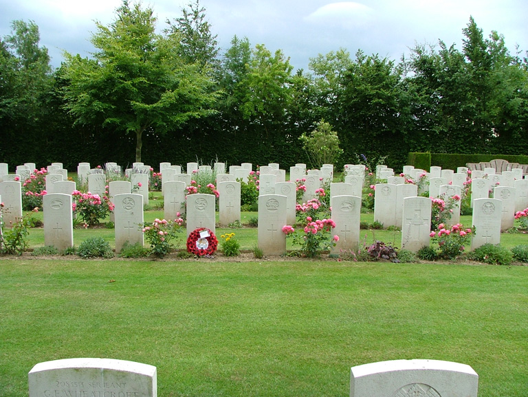
BAYEUX WAR CEMETERY, which was completed in 1952, contains 4,144 Commonwealth burials of the Second World War, 338 of them unidentified. There are also over 500 war graves of other nationalities, the majority German.
The BAYEUX MEMORIAL stands opposite the cemetery and bears the names of more than 1,800 men of the Commonwealth land forces who died in the early stages of the campaign and have no known grave. They died during the landings in Normandy, during the intense fighting in Normandy itself, and during the advance to the River Seine in August.